By Lotte Govaerts
(This post was originally published on the Rogers Archaeology Lab blog on October 25, 2022. You can see the original post archived here.)
This post is part of a series on the historical archaeology of the River Basin Surveys (RBS). In this installment I will discuss site 32ML2, which includes Like-A-Fishhook Village as well as Forts Berthold I and II, along with several other buildings associated with smaller-scale traders and Indian Agency buildings from a later period.
History of the Site
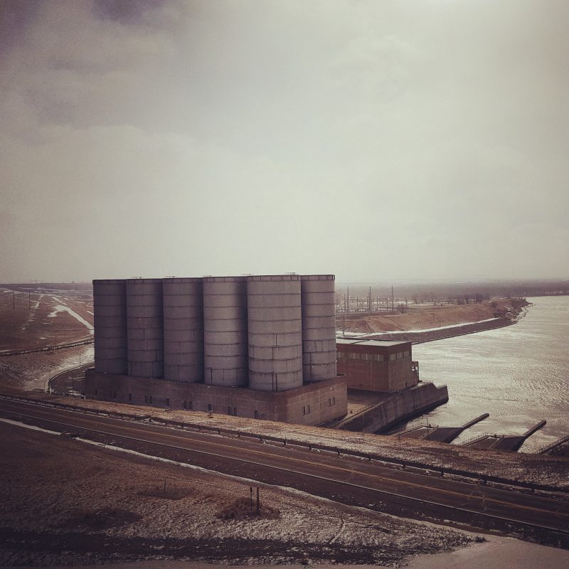
Site 32ML2, now under the waters of Lake Sakakawea, was located on the north side of the Missouri, opposite the mouth of L’Ours qui Dance (Dancing Bear Creek) in what is now McLean County. The village and first trade post were established there around 1845, on the first terrace above the floodplain.

It is uncertain when exactly the village was founded, but it is clear that not long after the devastating 1837 epidemic,[1] the surviving Mandan and Hidatsa moved north from their villages near Fort Clark (near present day Stanton, ND), to the region of 32ML2. It is also unclear if the trade post was built near the new village or the other way around, but evidence shows that by 1845, both a village and a functioning trade post existed at the site. The original founders of the village were probably Hidatsa, but it is possible the Mandan were also involved. At the very least they joined the Hidatsa shortly after its establishment (Smith 1972, p. 6–7). The Arikara did not move to the village until later. Around the time of the foundation of Like-A-Fishhook Village, they had taken over the abandoned village at Fort Clark to trade there with the United States. Frequent attacks by various Sioux tribes/bands and the traders’ abandonment of Fort Clark led them to leave that village in 1861 and establish a new one, Star Village, approximately two miles from Like-A-Fishhook, on the opposite bank of the Missouri. Star Village was short lived, however, for a series of attacks in 1861 (Like-A-Fishhook/Fort Berthold was also attacked at this time) caused the Arikara to abandon it and join the Mandan and Hidatsa at Like-A-Fishhook (Wood et al. 2011, p. 203–204).

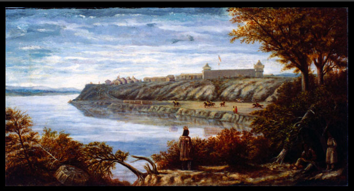
The village at 32ML2 is referred to as “Fort Berthold Village” in fur trade and other euro-American documents produced during its occupation. During the salvage project, researchers started using the name Like-A-Fishhook, based on information they obtained from several sources, as described by Smith (1972, p. 8, 26). One such source is Maxi’diwiac (Buffalo-Bird Woman), a Hidatsa woman born around 1839, who lived in the village. Her memories were recorded in 1912. She stated that the name of the village was Mu’a-idu’ skupe-hi’ cec, which translates to Like-A-Fishhook Village, referring to a nearby hairpin bend in the river (Wilson 1917, 1934, p. 7–8). A similar name , Bua idutskupe hisa a tis (Fishhook House/Village) appears on a map painted in the early 20th century by a Mandan man named Sitting Rabbit.[2] Martin Bear’s Arm, Hidatsa tribal historian, also drew a representation of the village as he remembered it, sometime after its abandonment (see image above).

The first trade post at this location was probably constructed by James Kipp or Francis Chardon for the Upper Missouri Outfit.[3] There are some references in the literature (see Smith 1972, p. 5) to a Fort James (presumably named after James Kipp). This was most likely an earlier name for Fort Berthold, rather than an earlier, temporary post. Letters and documents show that the name Fort Berthold was in general use by 1846. The name might be a reference to either Bartholomew Berthold (formerly partner of, and related by marriage to Pierre Chouteau, jr.) or his son, Pierre A. Berthold (nephew of Pierre Chouteau, Jr.) (Smith 1972, p. 5–6).
In 1858, an opposition company named Frost, Todd, and Company built a second trade post at Like-A-Fishhook Village, called Fort Atkinson. It remained in business only briefly, and when the original Fort Berthold burned down after a Dakota raid on Christmas eve 1862 (Smith, 1972, p. 119; Wood 2008, p. 5), the UMO took over the abandoned fort Atkinson, renamed it Fort Berthold II, and continued doing business there.
Military troops were stationed at the fort in 1864–1865. Although they stayed at the site through 1867 (when they moved to the newly constructed nearby Fort Stevenson), they were relocated to buildings outside the actual fort in April 1865. An Indian Agency was established at the location in 1868. Blacksmith and carpenter shops were built at this time, as well as saw- and grist mills. The agency moved to a new site a mile and a half away in 1875 because the original buildings were “vermin-infected” and “tumble down.”[5] The Three Affiliated Tribes started to abandon the village in 1885, as they were being pressured to settle on individual farms by the Indian Agent. By 1888, only a few Mandan were left at Like-A-Fishhook (Meyer 1977, 134–135).
Archaeology at 32ML2
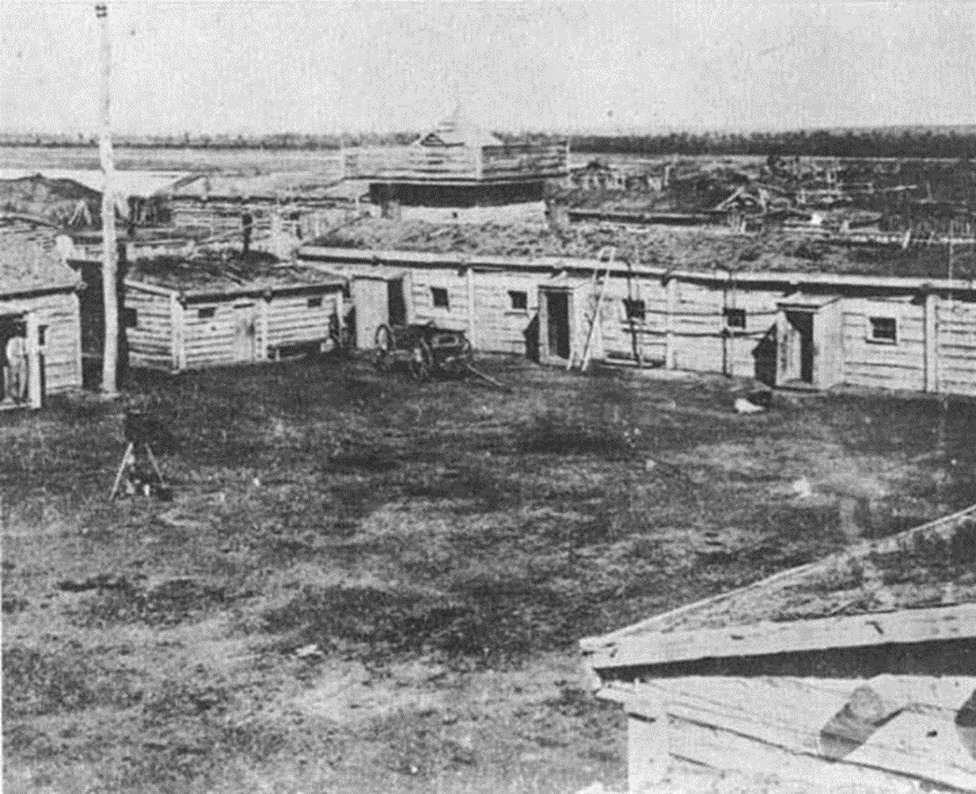
In 1950-52 and again in 1954, the State Historical Society of North Dakota undertook fieldwork at 32ML2. Smithsonian River Basin Survey crews conducted work there in 1952 and 1954. Several field reports were prepared describing this work, which were later synthesized by G. Hubert Smith in his 1972 volume on the site. Altogether, these crews excavated 20 earth lodges, parts of the original village stockade, the remains of Forts Berthold I (XU21) and II (XU30), and some other associated structures, including homes belonging to smaller-scale traders.
Like-A-Fishhook Village and the two posts covered a roughly circular area of approximately 40 acres (just over 16 hectares). The oldest section of the village was located between the two trade post locations. The first post burned around the same time the Arikara joined Like-A-Fishhook Village, and their new section of the village overlays the original post. The older section had a stockade surrounding it.
Investigators knew from Boller’s description (1868, p. 37)[6] that the remains of Fort Berthold I should be on the northern site of the village, but could not locate the fort during the earlier stages of the excavation. However, during the excavation of House 20 in 1952, underlying features predating the house were noted. These turned out to be part of the stockade of Fort Berthold I, which was subsequently excavated as well.

It appears the post underwent some alterations over the course of its existence. The original construction measured approximately 80 feet square (24.4 meters), but the stockade was later extended to approximately 121 feet E–W by 110 feet N–S (36.9 x 33.5 meters).
Fort Atkinson/Fort Berthold II was built on the edge of the river terrace on the south side of the village. It was not oriented to cardinal directions, but rather with one side of the stockade paralleling a section of the village palisade. Here too was some evidence of later enlargement. Boller described Fort Atkinson in 1858 as measuring 100 x 120 feet (30.5 x 36.6 meters) (Boller 1868, p. 72; Wood 2008, p. 93). The maximum dimensions of the stockade line found during excavation, however, were approximately 140 X 180 feet (42.7 x 54.9 meters) (Smith 1972, p. 131). The remains of several buildings and pits were excavated inside the stockade.
Artifact assemblages
As I have described before, in my dissertation I compare the artifact assemblages from six different trade post sites on the Upper Missouri. The assemblages from Forts Berthold I and II are included in this comparison, even though both are problematic for different reasons.
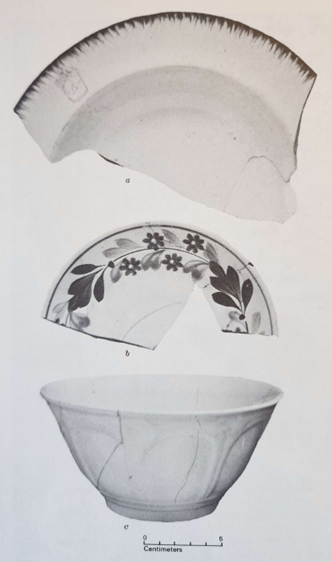
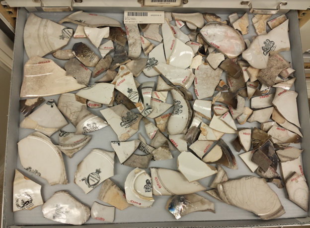
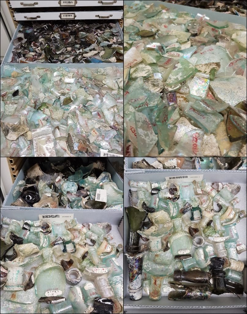
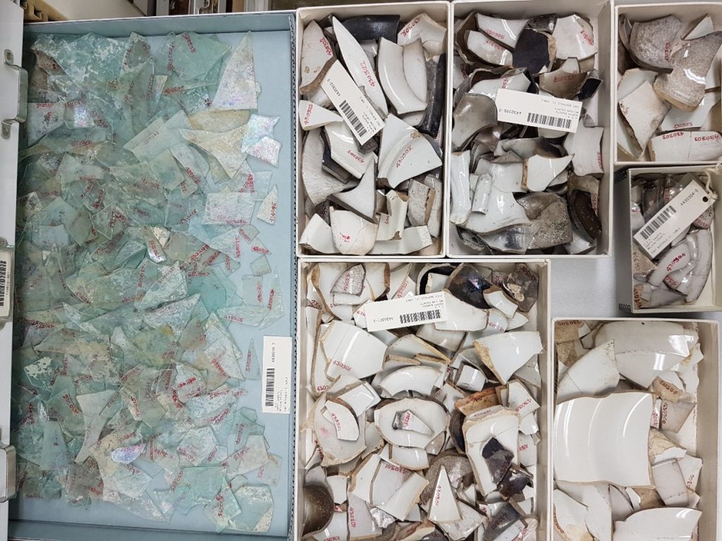
The total artifact count from Fort Berthold I is suspiciously low. A total of approximately[7] 3,680 objects was cataloged across 1,856 catalog numbers. Of those, I used 1,742 objects for analysis. Most likely, this number is low because the site was discovered late in the excavation process, and thus had to be excavated much faster than the rest of the area, in addition to the fact that the more recent section of the village intruded on the underlaying site. The excavation crews working on this site made an effort to distinguish intrusive features from features belonging to the fort occupation (Smith 1972, p. 95–96), and I have followed their judgment, subtracting features labeled as intrusive from my comparison sample. I used 1,742 objects from Fort Berthold I for my analysis. Almost half of those were glass beads (848). The next biggest categories were nails (238), glass containers (148) and imported ceramics (107).
Furthermore, Fort Berthold I is the only site in my comparison sample that burnt down while it was still occupied; all the other sites were intentionally abandoned. However, it does seem likely that the fort’s employees saved what they could and reused those items in the new fort, much like they did when intentionally abandoning a fort.
The artifacts from Fort Berthold I are curated by the State Historical Society of North Dakota. You can read more about the collection in a blog post by Meagan Schoenfelder, here. She has also written about artifacts collected from the village.
The problem with Fort Berthold II, by contrast, is that the general area as well as the actual fort buildings were occupied for a long time beyond the trade post occupation, and the artifacts from all occupations are mixed together, as is evident from the presence of artifacts such as coins that clearly postdate the trade post. Even so, some comparisons can still be made, as I will discuss in later installments. Approximately 24,500 objects were cataloged from the site, across 2,318 catalog numbers. Out of those, I used 20,761 objects for my analysis. Here too, the most plentiful object category was glass beads. I used 11,244 glass beads from Berthold II in my analysis. The next biggest categories here were imported ceramics (2,928), nails (1,967), glass containers (1,568), and windowglass (1,137).


In future installments of this series, I will write more about how I used these objects to compare the sites. But first, in our next post in this series, we’ll discuss one more site in the Garrison Dam area: Fort Stevenson, a military post that was in operation from 1867 to 1883.
[1] The steamboat St. Peters carried smallpox up the Missouri in 1837, and the resulting epidemic killed an estimated 17,000 people across the region. The semi-sedentary tribes of the Missouri were hit especially hard, both because they had less opportunity to avoid the outbreak than the more nomadic tribes, and because the US government’s vaccination program did not include them. These populations had already suffered various earlier disease outbreaks. The Mandan sustained the greatest losses of all, losing an estimated 90 percent of their population. The differential outcomes of the epidemic shaped intertribal relations and territorial expansions well beyond the 1830s (Daschuk 2013, p. 66–67).
[2] This map of the upper Missouri Valley from the approximate North/South Dakota boundary to just above the mouth of the Yellowstone depicts various landmarks, place names, and pictorial devices. Many villages pictured on the map were long abandoned when the map was drawn in 1906–7? (see Thiessen et al. 1979 for more history on the map).
[3] As we have discussed previously, the Upper Missouri Outfit (UMO) was the name given to the former Columbia Fur Company after it was bought out by The American Fur Company. In 1834, John Jacob Astor sold the UMO to Pratte, Chouteau & Company, which was reorganized as Pierre Chouteau, Jr., & Company in 1839. It remained in business until it was sold to the Northwest Fur Company in 1865.
[4] Philippe Regis de Trobriand was a French aristocrat who moved to the United States and later served in the US military. He was the commander of Fort Stevenson (near Fort Berthold) in the late 1860s. While stationed in North Dakota, he painted a number of landscape scenes and portraits.
[5] “Those now in use for that purpose are old, vermin-infected, tumble-down log buildings erected many years ago by the North American Fur Company,” United States Office of Indian Affairs, Annual Report of the Commissioner of Indian Affairs for the year 1874 (United States Government Printing Office, 1874).
[6] Henry A. Boller (1836–1902) worked as a clerk for Frost, Todd, and Company and was employed at Fort Atkinson for two years (1858–1860) until the firm was absorbed by the American Fur Company. He subsequently joined the newly created Larpenteur, Smith, and company as a junior partner, and returned to Like-A-Fishhook during the winter of 1860–61, until the company dissolved. Boller returned to St. Louis and retired from the fur trade. The journals he kept at Like-A-Fishhook offer valuable insight into life at the post. See Wood 2008.
[7] The total number is an approximation because the final object count for some artifacts is unknown and because some objects can’t be counted in the same way as others (for example, burned botanical remains).
References
Boller, Henry A. Among the Indians. Eight years in the far west: 1858–1866. Embracing sketches of Montana and Salt Lake. Philadelphia: T. Ellwood Zell, 1868.
Daschuk, James William. Clearing the Plains: Disease, Politics of Starvation, and the Loss of Aboriginal Life. University of Regina Press, 2013.
Meyer, Roy W. The Village Indians of the Upper Missouri: The Mandans, Hidatsas, and Arikaras. Lincoln: University of Nebraska Press, 1977.
Smith, G. Hubert. “Archeological Work at 32ML2 (Like-A-Fishhook Village and Fort Berthold) Garrison Reservoir Area, North Dakota, 1950-1954.” Plains Anthropologist 2 (1954).
Thiessen, Thomas D., Wood, W. Raymond, and Wesley A. Jones, “The Sitting Rabbit 1907 Map of the Missouri River in North Dakota.” Plains Anthropologist 24, no. 84 (1979): 145–167.
Wilson, Gilbert L. Agriculture of the Hidatsa Indians: An Indian Interpretation. Studies in the Social Sciences 9. University of Minnesota, 1917.
Wood, Raymond H. Twilight of the Upper Missouri River Fur Trade, The Journals of Henry A. Boller. Bismarck, N.D., 2008.
Wood, W. Raymond, W. F. Hunt, and Randy H. Williams. Fort Clark and Its Indian Neighbors: A Trading Post on the Upper Missouri. Norman: University of Oklahoma Press, 2011.
Previous posts in this series
What is Historical Archaeology?
How the River Basin Surveys Shaped Historical Archaeology
The Upper Missouri River Basin in the Nineteenth Century: Fur Trade
The Upper Missouri River Basin in the Nineteenth Century: Military Frontier
The Upper Missouri River Basin in the Nineteenth Century: Indian Agencies
Lake Sakakawea and the Woman it was Named After